
Snow Expected in Southern Oregon Mountains as Cold Front Arrives Sunday Night
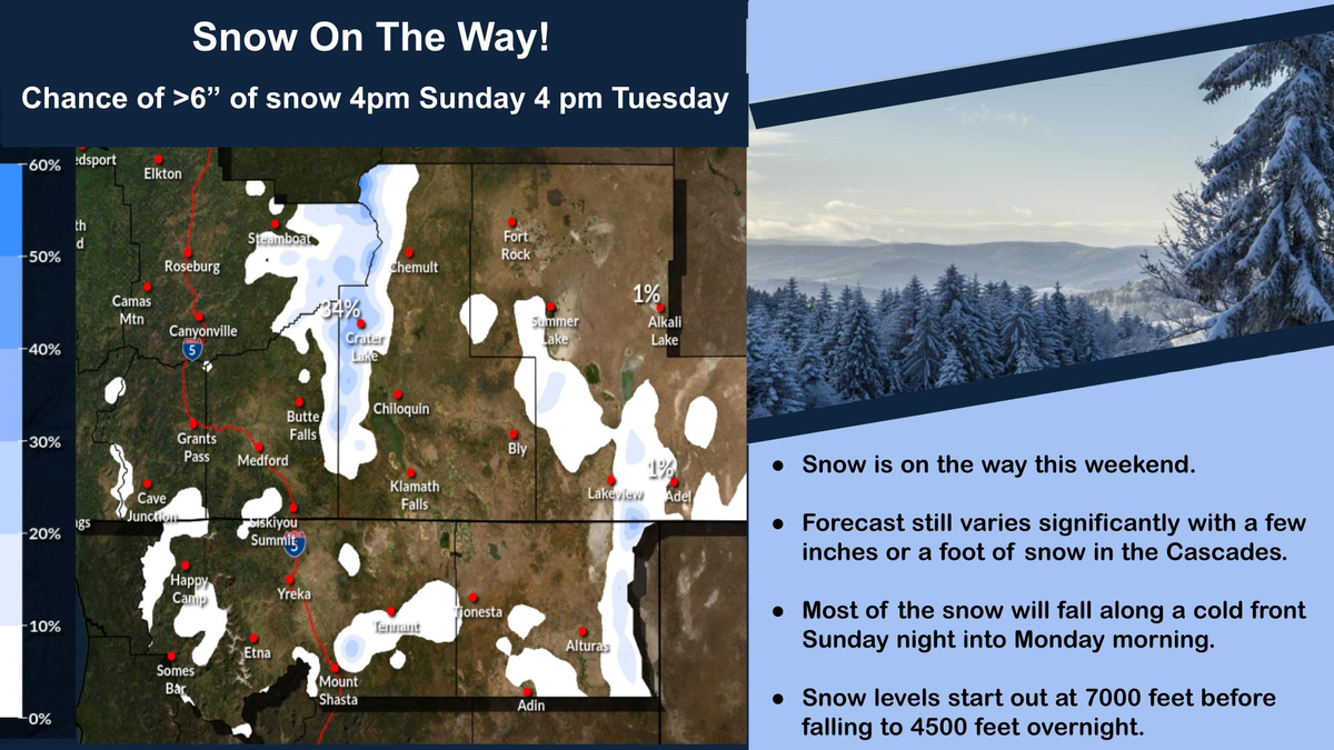
A cold front moving into southern Oregon Sunday night is expected to bring mountain snow into Monday morning. Most areas in the Cascades could see 4 to 6 inches, with a small chance of up to a foot. Snow levels may drop to around 4,500 feet overnight, potentially impacting higher elevation travel.
DOUGLAS COUNTY, Ore. — A cold front moving through southern Oregon late Sunday into Monday is expected to bring snow to the mountains, with accumulating snowfall likely in higher elevations across the region.
Forecasters say snow will begin moving into the Cascades and surrounding mountain areas Sunday evening, with the bulk of the precipitation expected overnight into Monday morning. Current projections indicate 4 to 6 inches of snow is the most likely outcome for many mountain locations, though snowfall totals could vary depending on how the system develops.
There is also about a 10% chance of snowfall totals approaching 12 inches in parts of the Cascades if conditions align for heavier precipitation.
Snow levels are forecast to start around 7,000 feet Sunday evening before dropping to approximately 4,500 feet overnight, which could allow snow to reach lower mountain passes by early Monday. Areas at or above pass level could see accumulating snow, especially during the overnight hours.
Forecast models continue to show some variation in the exact amount of snowfall, and totals may change as the storm approaches. Most of the snow is expected to remain in higher elevations, while valley areas are not currently forecast to see significant accumulation.
Travelers planning to cross mountain passes late Sunday through Monday morning should monitor conditions and be prepared for winter driving conditions, including possible snow-covered roads and reduced visibility.
Additional forecast updates are expected as the cold front moves closer to the region.


Comments ()