
National Preparedness Level Raised to 2 Amid Rising Wildfire Activity
NMAC raised the National Preparedness Level to 2 due to rising wildfire activity and resource commitments. Since Feb. 28, 59 large fires have been reported. Elevated fire potential is expected in Texas, New Mexico, Arizona, and the Southeast through March and April.
March 4, 2025
The National Multi-Agency Coordinating Group, or NMAC, moved to National Preparedness Level 2 this morning. This is due to a significant increase in wildfire activity in multiple geographic areas, coupled with the potential for additional emerging wildfires this week. There has also been an increase in committed resources to ongoing incidents across the country.
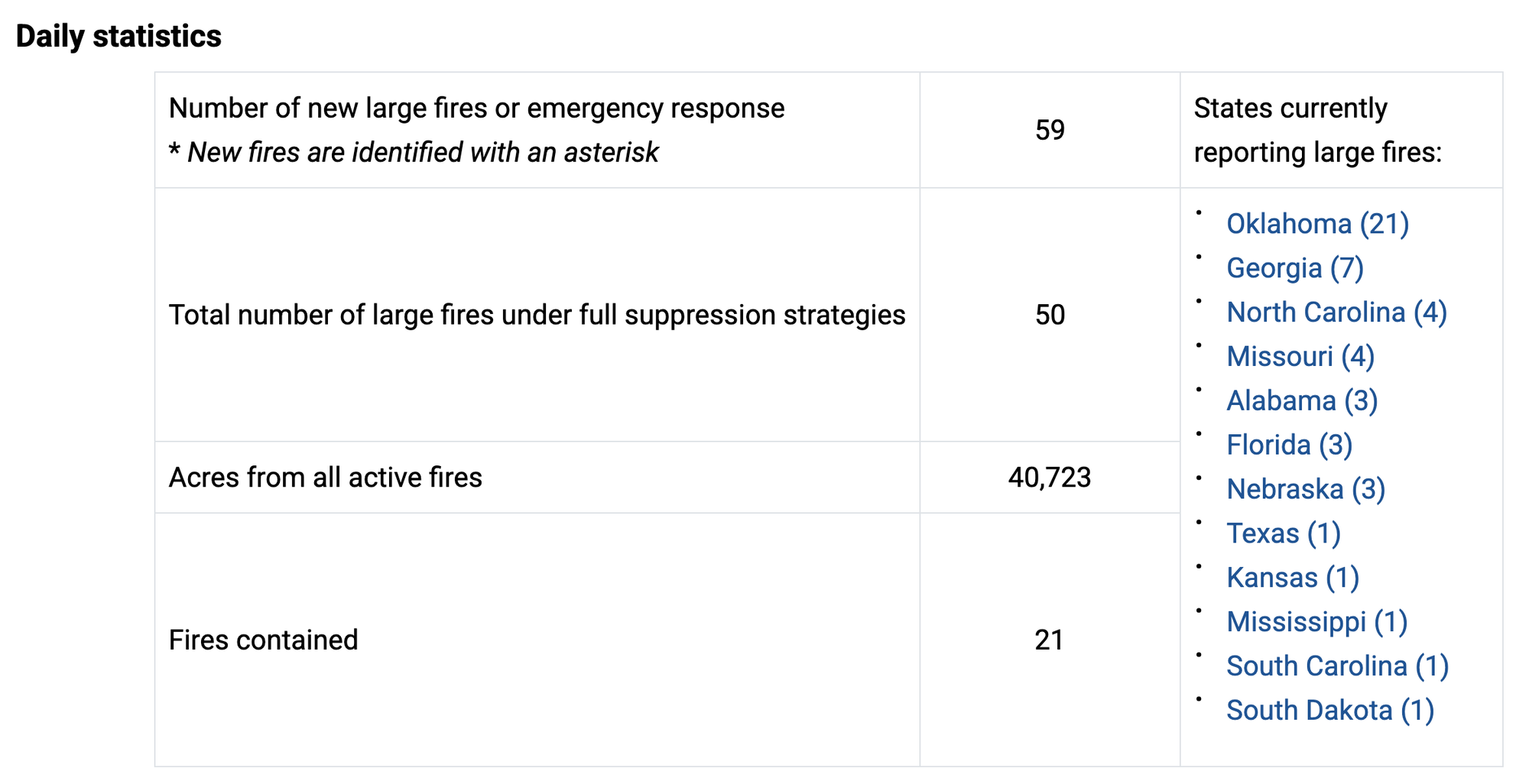
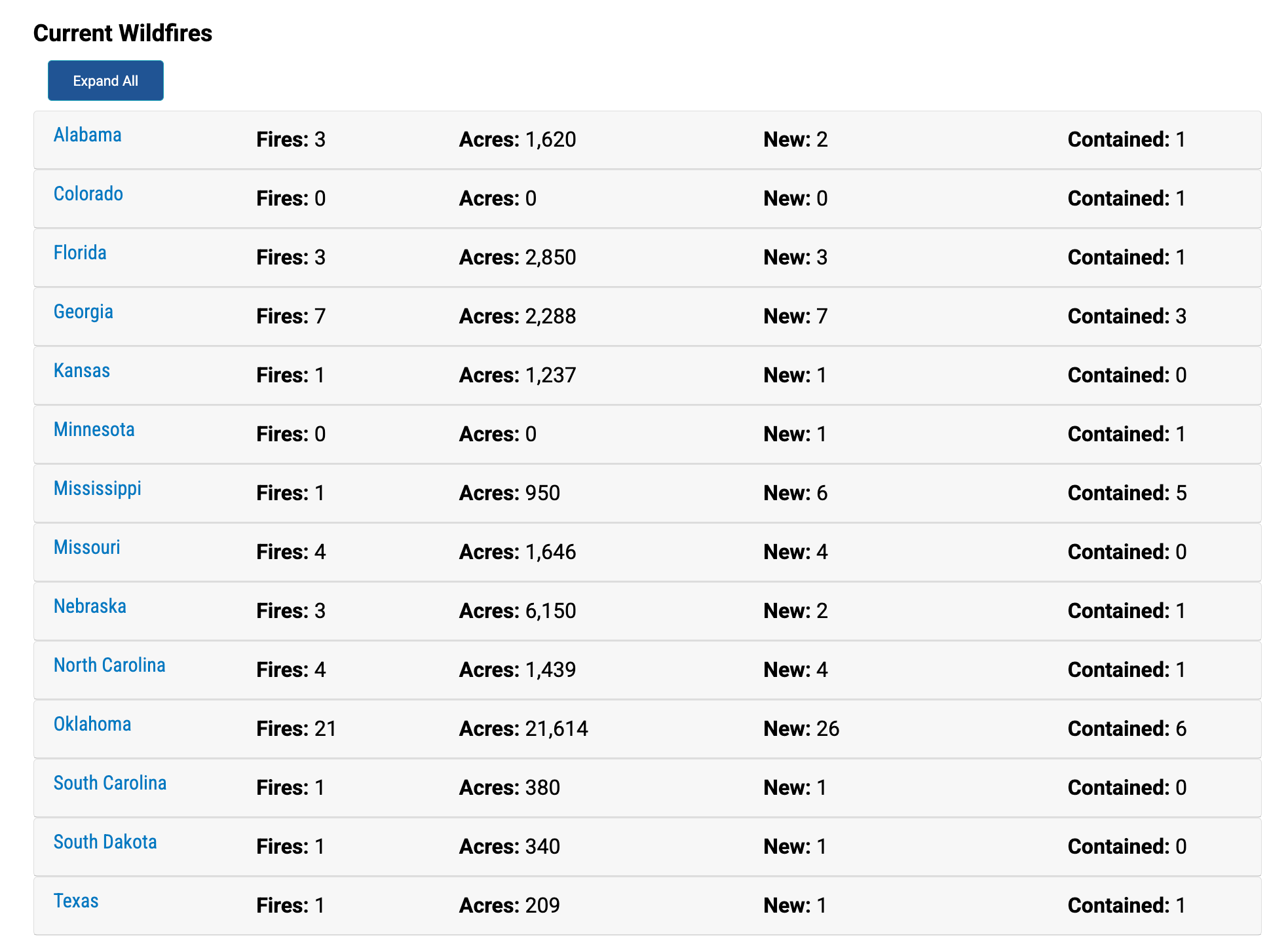
Since February 28, 59 new large fires were reported, with the majority in the Southern Area and the rest in the Rocky Mountain and Eastern Areas. 100% containment has already been achieved on 21 of these fires.
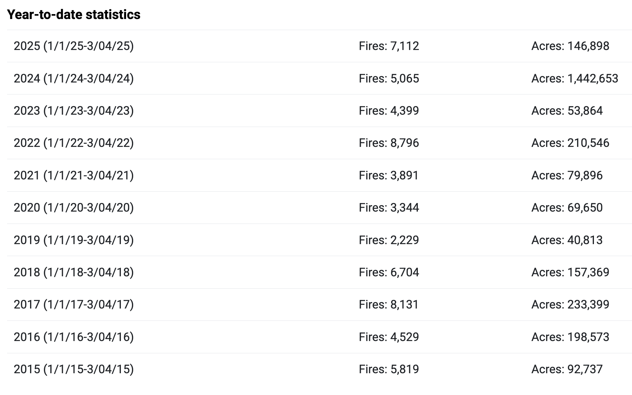
So far in 2025, 7,112 wildfires have burned 146,898 acres across the United States. This is above the 10-year average of 5,179 wildfires and below the 10-year average acreage of 252,826.
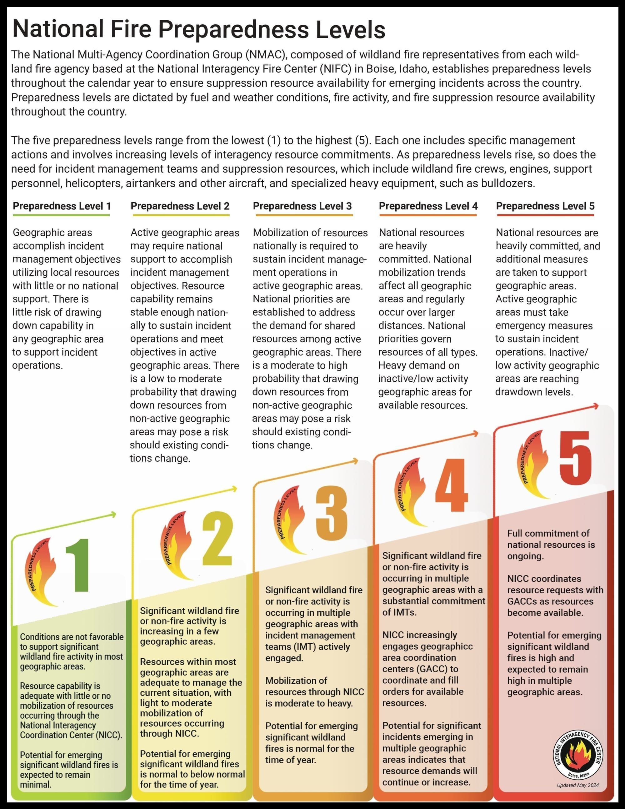
This is the second time in 2025 the National Preparedness Level increased to 2. On January 9, the level increased to 2 for about three weeks in support of the wildfires in southern California. For additional information about the National Preparedness Levels, visit the Fire Information page.
The National Significant Wildland Fire Potential Outlook is available for the period of March through June 2025. Significant wildfire potential will be seen throughout most of Texas and parts of New Mexico and Arizona, and several southeastern states through March and into April.
Weather
The strong storm in the central Plains will move into the Mid-Mississippi Valley tomorrow. Strong westerly winds will occur ahead of the cold front and west of the dry line from southeast New Mexico through much of Texas, pushing into East Texas, eastern Oklahoma, and western Louisiana in the afternoon. Minimum relative humidity will fall to 5-20% across these areas, possibly as low as 10% as far east as East Texas. Widespread critical to extremely critical conditions are forecast, although conditions across Oklahoma are likely to be mitigated by recent rainfall, elevated initial attack may continue there. Strong to severe thunderstorms will develop ahead of the dry line in the Lower Mississippi Valley tomorrow, while strong southerly winds develop in the Southeast. Southerly winds of 15-25 mph are forecast, and while minimum relative humidity will increase to near or above 20%, elevated to critical conditions are likely. Of particular concern will be the west slopes of the Appalachians, especially far eastern Tennessee late this afternoon and tonight. A period of strong downslope winds gusting to 70 mph are expected along with poor overnight relative humidity recovery, creating localized areas of extremely critical conditions. Precipitation is likely to arrive in the southern Appalachians toward Wednesday morning, greatly moderating the conditions. On the north side of the storm, widespread precipitation is forecast from the central Plains to the Great Lakes. Snow is forecast on the northern periphery with blizzard conditions likely from northeast Colorado and western Nebraska into central Minnesota. Another upper-level low will move onto the West Coast during the day, with light valley rain and mountain snow from central California into the Northwest. National Predictive Services Outlook 6 Minutes for Safety: The 6 Minutes for Safety topic of the day is Leader's Intent.
Preparedness Levels Descriptions


Comments ()